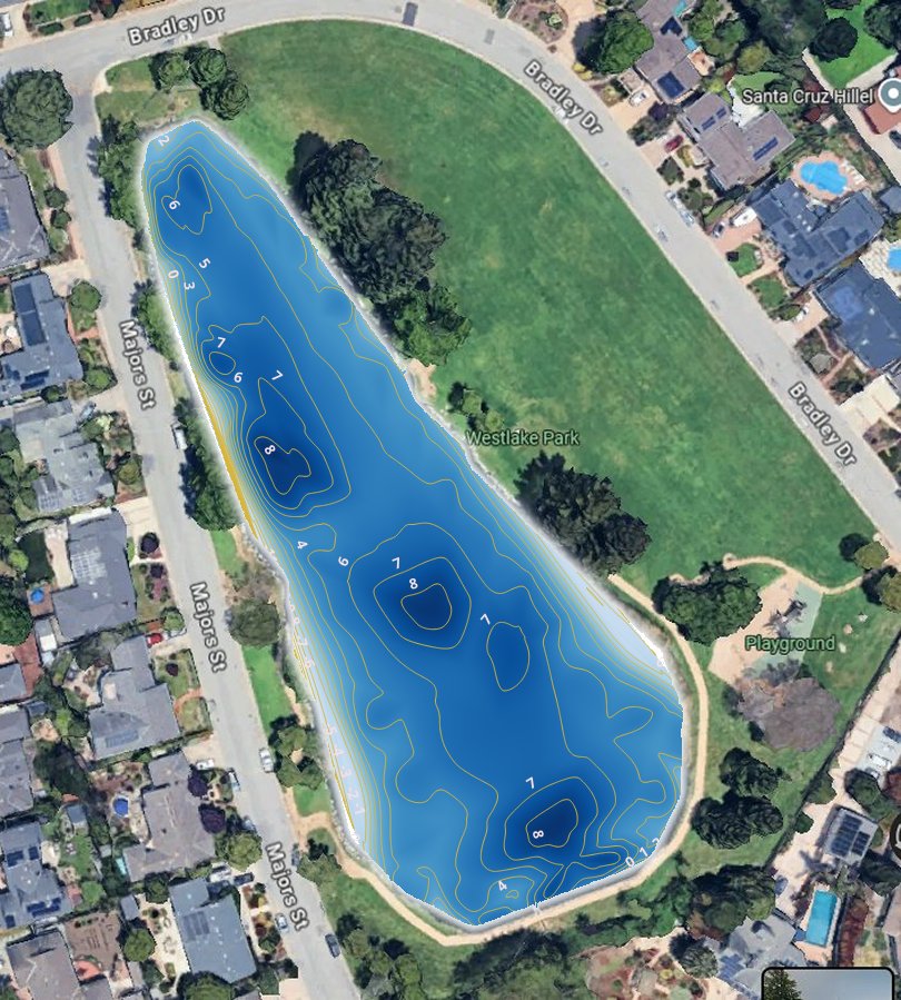
Depth contour map showing interpolated depth (in feet) of Westlake Pond from surface to ground.
This was measured by lowering a pole to the muck and then pushing down until the pole hit firm ground (e.g., sand or rock).
Depth contour map showing interpolated depth (in feet) of Westlake Pond from surface to water-muck interface.
This was measured by allowing a pole to slowly drop until muck (soft sediment) "caught" the pole.
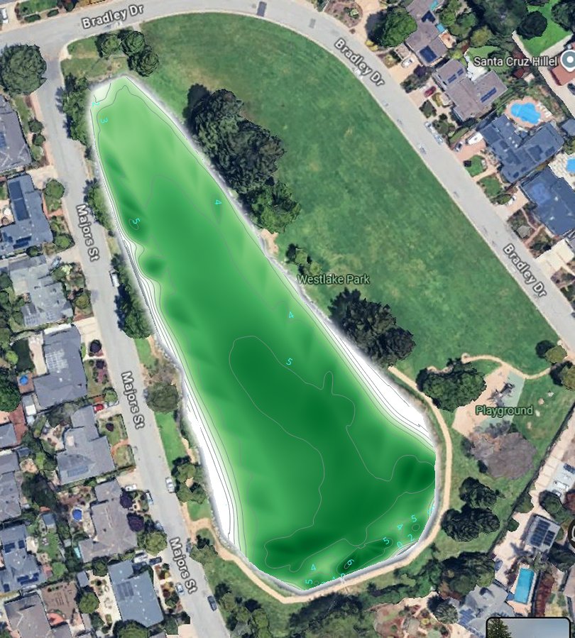
Data to produce these maps was collected on September 7th and 8th, 2026. Seventy-five depth points were collected in groups of 5 along a transect from the north end to the weir (along with a few extra groups of points). These were entered into QGIS, TIN interpolated, colorized, and then contoured.